
A very useful, and very unnerving, webpage
Last week, I was sent a link to a website that was at once fascinating and informative, and at the same time unnerving. Allwyn alerted me to flightaware.com, a website that allows you to track all planes in the air, their airports, their origins and destinations, and a multitude of other factors. As you can see form the homescreen below, there are a re a ton of things you can do, from tracking airlines, to checking airport status, to determining arrival, departure, and current locations of flight, to checking the weather, and a ton of others.
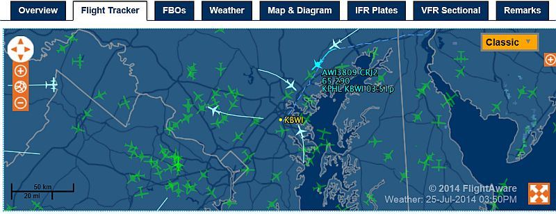
 I thought I would give it a run with the airport of my adopted hometown, Baltimore-Washington International (BWI) in Baltimore, Maryland. Massive international hub that it is, it can’t be seen on the small national map on the right unless you zoom in, and I’m ok with that. That map also shows real-time storm tracking – very impressive.
I clicked on ‘Live Flight Tracking,’ then ‘Browse by Airport’ (although you can also browse by flight, by aircraft type, and by operator among others), and entered ‘BWI’ into the search box. I was greeted with the following screen, that shows all flights currently inbound and outbound from the airport.

BWI information page
An earth-view that shows terrain is available, even infrared views! Hovering the mouse over an airplane icon shows information about that airline, and if you click on it you will be taken to a page that gives further information, including its starting point and departure time, the type of plane it is, its current and final altitude, as well as its destination and estimated arrival time (screen below). Not only that, the planes’ positions are updated in real time, so they are all slowly moving across the screen as you watch.
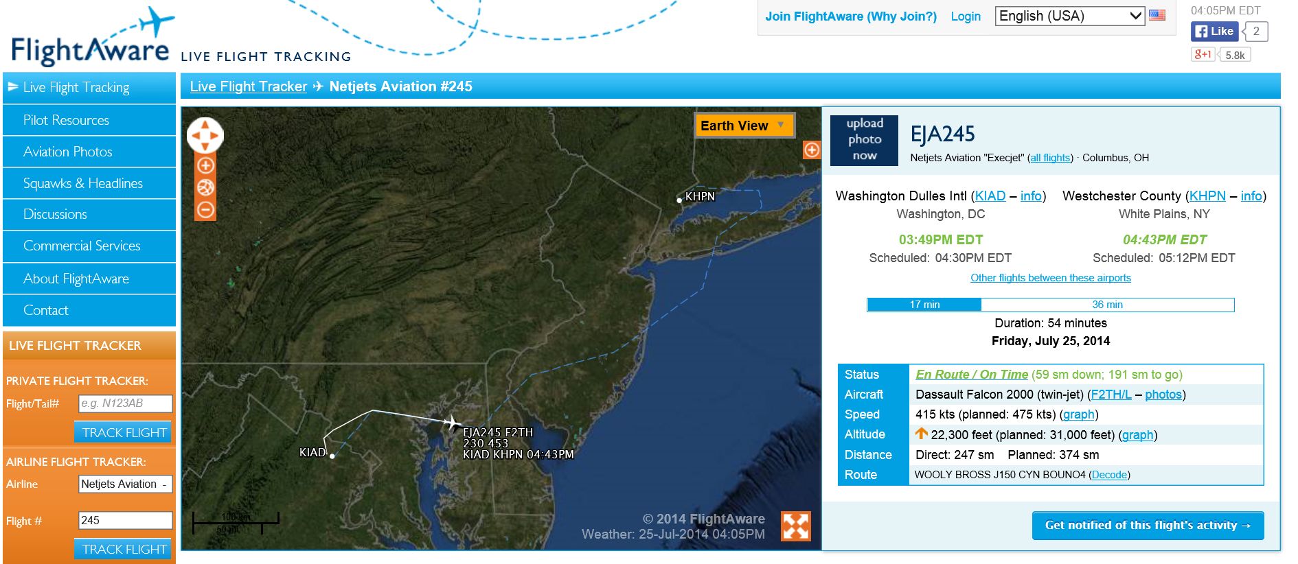
Flight information for a specific flight
There is a lot you can do, and while this is easily one of the most amazingly useful and informative sites I’ve ever seen, it also fills me with unease. This year has been one of the most deadly in aviation history, and although the contributors to that have been overseas in hostile territories, and even considering air travel is still the safest means of travel by far, but if we can have mapping services that can tell someone how to drive directly to your house, perhaps this isn’t so bad after all, and nothing has happened as a direct result of it. To be fair, none of tit is classified information, you can get the same information by visiting an airport/airline website or calling their number. Which means I could see myself really using this site.