
Interactive map of undersea fiber-optic cables
If you remember our discussion of networking, we talked about the Internet backbones which are vast, high-capacity fiber optic cables that traverse the ocean floor and connect major regions, countries and continents in a gigantic, overarching network that we refer to as the Internet.
Fiber optic cable is used because, as you’ll remember, it is not susceptible to interference from outside forces as it uses light being sent through a shielded, or in the case of fiber optic, ‘cladded,’ cable. These pathways can be owned and managed by academic or government institutions, as well as private telecommunications companies.There’s a great explanation of the physical cable on Wikipedia of all places.
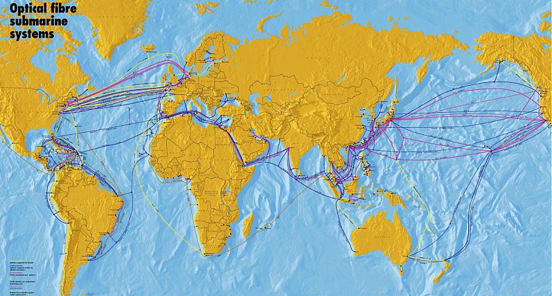
I sensed some doubt in a few of you that cables were truly stretched along the ocean floor. Well, they are, and I would like to present you all with a link to the Submarine Cable Map, which provides a ton of information about each individual sub-oceanic fiber backbone that is out there today. That’s a picture of it below.
 You can click on any of the trans-continental or inter-continental cables you see on the map and it will provide you with a wealth of information for each one, including when it was ready for service, what points it connects, and who owns it with their website. Some of them are owned by 20 or more companies!
 The map uses standard controls for zooming and navigating, if you’ve ever used Google Maps you’ll be fine. You can click on any backbone segment to see relevant information, and click on an empty part of the map to reset them all. It’s very interesting to see the ways all the countries and continents connect among and within themselves.